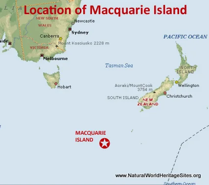
A significant earthquake struck west of Macquarie Island on Sunday, April 27, 2025, at 07:22 pm (GMT +10).
The earthquake measured a magnitude of 6.0, according to the Earthquake Monitor. This region is prone to seismic activity due to its location on the tectonic plate fault lines, where two plates slide against each other, causing earthquake activity close to the island.
The Australian earthquake center, specifically Geoscience Australia, monitors seismic activity across the globe, including the Macquarie Island region. According to their reports, Macquarie Island is located in a seismically active area due to its position on the tectonic plate fault lines, where two plates slide against each other, causing earthquake activity close to the island

Seismic Activity in the Region
Macquarie Island is located in a seismically active area, with several earthquakes occurring in the region recently. Another earthquake with a magnitude of 4.6 was reported west of Macquarie Island just 29 minutes after the initial quake.
Key Details:
- Magnitude: 6.0
- Location: West of Macquarie Island
- Time: Sunday, April 27, 2025, at 07:22 pm (GMT +10)
- Depth: Not specified

Key Points about the history of the Macquarie Island Earthquake Region:
- Seismic Activity: The region experiences a high level of seismic activity, with at least 2 quakes above magnitude 7 since 1900.
- Average Earthquakes per Year: There are approximately 3.4 quakes on average per year in the area near the epicenter.
- Magnitude Distribution:
- Magnitude 7 or higher: 0.02 quakes per year (or 1 quake every 62.5 years)
- Magnitude 6 or higher: 0.06 quakes per year (or 1 quake every 17.9 years)
- Magnitude 5 or higher: 0.44 quakes per year (or 1 quake every 2.3 years)
Geoscience Australia, in partnership with the Australian National University, has deployed seismometers around Macquarie Island to better understand earthquakes and tsunamis in the region. This project aims to collect data that will help scientists predict how seismic energy from hypothetical future earthquakes spreads and simulate different scenarios of wave propagation for earthquakes and tsunamis.

Impact and Response
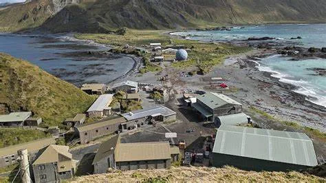
The Australian Antarctic Division has monitoring equipment on Macquarie Island, which forms part of the global seismograph network that monitors earthquakes worldwide. Expeditioners on the island conduct regular drills, including tsunami evacuation drills, to prepare for seismic activity. While the recent earthquake didn’t require evacuation, the drills ensure they are ready in case of an emergency
